Real-time air traffic information
Real-time air traffic information allows you to expand your situation display with up-to-date information on the air situation in your area of operation.
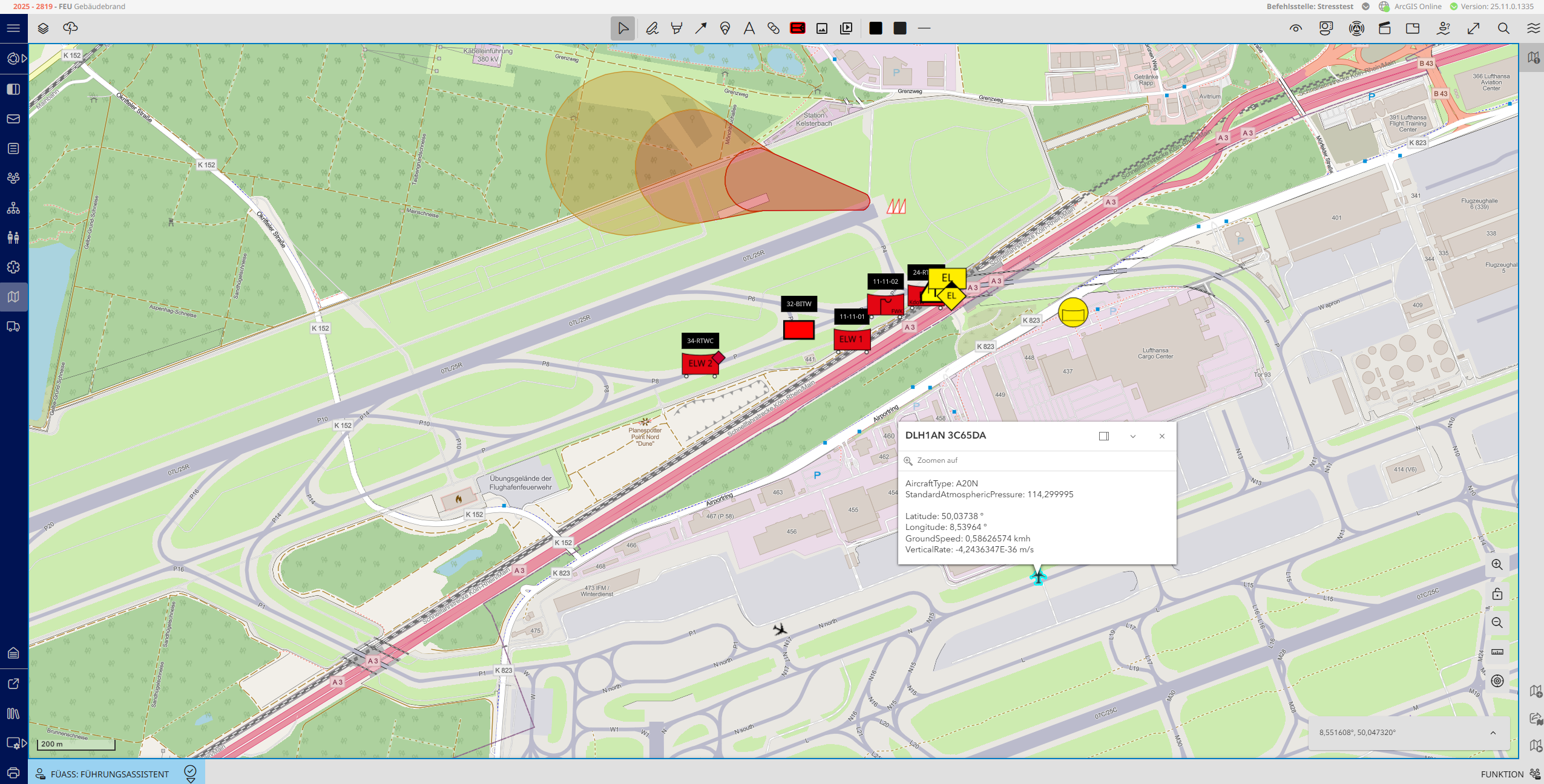
Integration is carried out via CIMgate.Connect, which runs a specially developed Droniq agent. This agent automatically transmits the live data to CommandX without requiring any additional operator effort.
Within a predefined radius, CommandX not only displays all detected flying objects, but also important metadata such as:
- Identification of the aircraft
- Position (latitude and longitude)
- Flight altitude (AGL/MSL)
- Movement data such as speed and climb/descent rate
This data is displayed as a separate layer on the situation map and can be shown or hidden as required. This allows you to maintain a clear, focused picture of the situation at all times and safely incorporate air traffic into your operational planning.

![[Translate to English:] Finn Drümmer (Projektmanager, Eurocommand GmbH), Carsten Weiske (Prokurist, Eurocommand GmbH), Heiko Blume (Landrat Landkreis Uelzen), Daniela Behrens (Innenministerin Niedersachen), Dieter Ruschenbusch (Regierungsbrandmeister LG2), Dr. Hilke Sophie Wichmann (Projektleiterin, MI Niedersachsen)](/fileadmin/user_upload/neugikeiten/Bild-ba7802a57a236d8g9c41e1f72006a844.jpg)