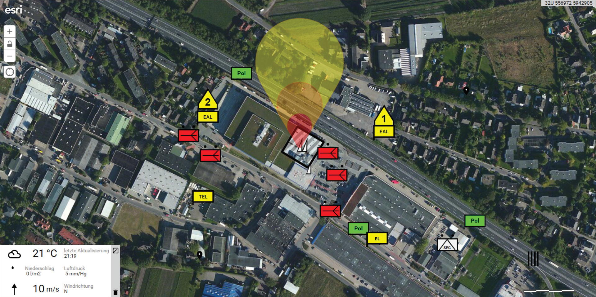
Tactical Map
The management of tactical maps is now indispensable in modern emergency response management, as the recognition of spatial contexts is the basis for making important decisions. The tactical map module of CommandX offers a wide range of possibilities for using geographic data to develop solutions. Due to the full integration of the ArcGIS platform, CommandX is currently the only system with a bidirectional 64bit interface to the ArcGIS Server and the Esri Portal. In addition, CommandX supports the control of the interactive systems from SMART Technologies.

ArcGIS plattform
As one of the world‘s leading providers of geo-information systems, Esri provides the foundation for the map data in CommandX. Whether you need a simple map, geoanalysis or dispersion calculation, the complete integration of ArcGIS Runtime into CommandX provides you with all the professional position indication options.
Access to municipal geodata infrastructure
How many residents live in the affected area? This question and many more are easily answered
by the full integration of Esri‘s ArcGIS platform. Floods, water levels, pollutant dispersal, public facilities,
hydrants, etc. – with live integration of your data, you have access to relevant geo-information at any time and can display it on the tactical map.
Tactical times
DV102 tactical signs are available in CommandX for a clear display of the situation. What‘s more: If a unique tactical sign is required, a sign that complies with regulations can be created in the symbol generator. An explanatory function provides assistance to users with no tactical training.
Publisher / viewer rights structure
From the mayor to the geoanalyst. Different user groups have different requirements for the tactical
map. With rights management, the respective users can be granted different rights. Thus, the so-called viewer is exclusively equipped with reading rights and the so-called publisher with additional processing and publication rights.
Diverse Map Material
CommandX offers a variety of possibilities for tactical map creation with different map views. The use of online maps with road, aerial or topographical views is possible, as is the simple creation of your own site maps with the whiteboard function or the uploading of object plans from a file.
Real-time logging
In order to understand the development of the situation and the measures that have been initiated, it is
possible to jump to any point in time during the emergency response process. A tactical map film shows
the historical process in real time and thus provides a court-relevant documentation of the operation.
Ihr Ansprechpartner

Carsten Weiske
Tel.: 040 / 239 69 63-31
Fax: 040 / 239 69 63-99
Mobil: 0171 / 22 17 112
© eurocommand 2015 · all rights reserved · imprint · disclaimer · Data protection


