Telematics, GPS, Drones, and Video Technology
Telematics and GPS
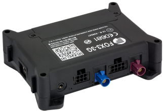
Telematics and GPS are an integral part of professional fleet management today. This technology is increasingly being used in disaster control and emergency vehicles. However, it is only useful if the command software is prepared to directly import and display the data.
CommandX offers this
option. On the situation map, a separate level shows detailed information about
the employed units: Where are they – and where were they several minutes ago?
What is their status? How many SCBA users are on board – and is their equipment
operational? How much water is left in the unit‘s tank? Does the generator in
the back have enough fuel? Thanks to telematics‘ complete integration, all of
these data are available in CommandX – in real time.

Drones and Video Technology
An electronic situation map is not very useful without complete information. Are the containers in a no longer accessible location labelled? What is located in the area behind the operation site that is not visible to the emergency personnel? What dangers are waiting? How is the wind at the operation site? What temperatures and what hazardous materials are being measured?

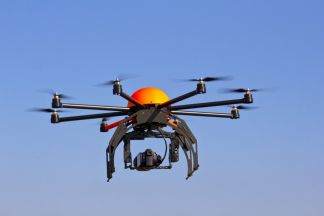
With our drones, your experts on site have direct access to detailed information. That includes current weather data and live videos. With CommandX, this information can be imported immediately, and the sensor data, photos, and videos quickly give a complete and informative overview of the situation.
Your contact person

Carsten Weiske
Tel.: +49 40 / 239 69 63 - 31
Fax: +49 40 / 239 69 63 - 99
Mobile: +49 171 / 22 17 112
© eurocommand 2015 · all rights reserved · imprint · disclaimer · Data protection


