Professional Tools for Operational Command
GeoFES: the operational command system for government agencies and organizations with public safety tasks. GeoFES supports unit leaders in standard operations, in large-scale and extensive damage situations due to fires or natural events including storms, torrential rain, or flooding. Also included are anthropogenic damages, ABC situations, epidemics, and accidents.
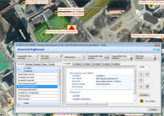
Consistent Use of Geographic and Tabular Information
GeoFES is especially notable for its comprehensive integration and use of geographic information in order to survey the area in advance and to generate spatial analyses. The digital situation map, including very fast and efficient operation section generation, is easy to operate.
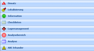
Flexible and Easy to Operate
GeoFES can be specifically configured for unit leaders, technical command centers (TEL), and crisis staff roles. Furthermore, GeoFES is a powerful tool for the organizational-administrative side of hazard prevention, for example in cities and counties.
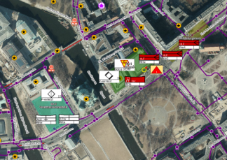
Administration of all Operational Data
By importing all operational data from the command center, several layers can be simultaneously managed and administrated. The geographical integration of tactical symbols according to DV 102 completes the situational overview.
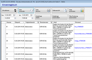
Automatic Documentation for Reporting
All actions concerning the operation are automatically logged in the incident log and in the archive. The generated documents are referenced, for example hand cards, damage accounts, situational overviews, analyses, and overviews of unit strengths. That way, a review and extensive follow-ups are always possible.
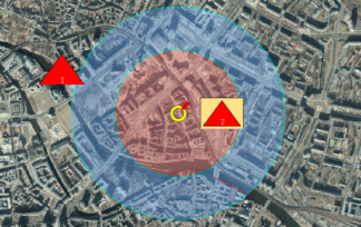
Quickly Identifying and Eliminating Potential Hazards
Based on geo-information, ad hoc identification of endangered areas is possible, including areas to be searched, warned, and evacuated according to a fast analysis of the affected population and protected goods. Statistical or analysis-based checklists support processing according to standardized operational
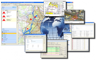
Additional features of GeoFES include
- role and task-based inter-agency cooperation
- context-relevant information
- simple usability
- interface to calculation modules
- Smartboard interface
Your contact person

Carsten Weiske
Tel.: +49 40 / 239 69 63 - 31
Fax: +49 40 / 239 69 63 - 99
Mobile: +49 171 / 22 17 112
© eurocommand 2015 · all rights reserved · imprint · disclaimer · Data protection


